Airport Radar
|
Airport Radar |
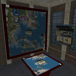
This airport radar system use the media prim system to display a map of the immediate area around the region in which it was rezed overlaid with traffic using the SA transponder system. There are four zoom levels ranging from single region out to a 7x7 grid of regions centered on the airport. While the data displayed is the same as that available from the Shergood Aviation web site interface at http://shergoodaviation.com/radar.php, the in-world devices use an alternate web interface that has been optimized for in-world use.
1 OPERATION
Table and Wall Versions The table and wall versions of the device include a power switch to turn the device on and off. Just click the ON/OFF button to toggle power. Once the device is powered on and you see a screen that says "Click to View Grid Radar", you can click on the screen to begin viewing the media displayed on the screen. The table and wall versions are modify and can be linked with other prims without affecting operation. In addition to the ON/OFF button, there is a reload button that can be used to reload the prim media if there is a problem, and a menu button to bring up menu options. Through the menu the owner can set access to the menu and check for updates. There is also a location select option with the access level set by the owner. You can set the map to display at the current location (the default), or choose a location from any landmarks dropped in the object contents.
1.1 Single Prim Version
To use the single prim version, simply rez it, then click the screen where it says "Click to View Grid Radar". The single prim version is also modify. It is also possible ro remove the "map" script and use it in your own prims. You can use the full-perm "map api" script as reference on how to use it.
1.2 Web Media
The web media displayed by either device is interactive and includes a zoom control, and an overlay select allowing you to choose which of airports, traffic, notams or region status you wish to display.
2 MAP API
The map script can be controlled through link messages. The full-perm "map api" script included in the single-prim version of the radar system shows an example of how to communicate with the map script. The only required message is the SA_MAP_CONFIG message which must define the prim# and face# on which to display the radar media. The string component of the configuration link message should be a JSON formatted string with parameter/value pairs. The llList2Json() function can be used to format the string. For example:
string json = llList2Json(JSON_OBJECT,["prim",3,"face",1,"mode","map","power","1"]);
llMessageLinked(LINK_SET,SA_MAP_CONFIG,json,NULL_KEY);
will configure the map script to display on face #1 of prim #3 in the link set. The mode is set to "map" (currently the only mode supported with this script), and power is set to 1 (i.e., on).
Link messages sent to the map script are acknowledged with a SA_MAP_OK, SA_MAP_ERROR or SA_MAP_STATE message. These can be ignored if they are not required by the client script.
